

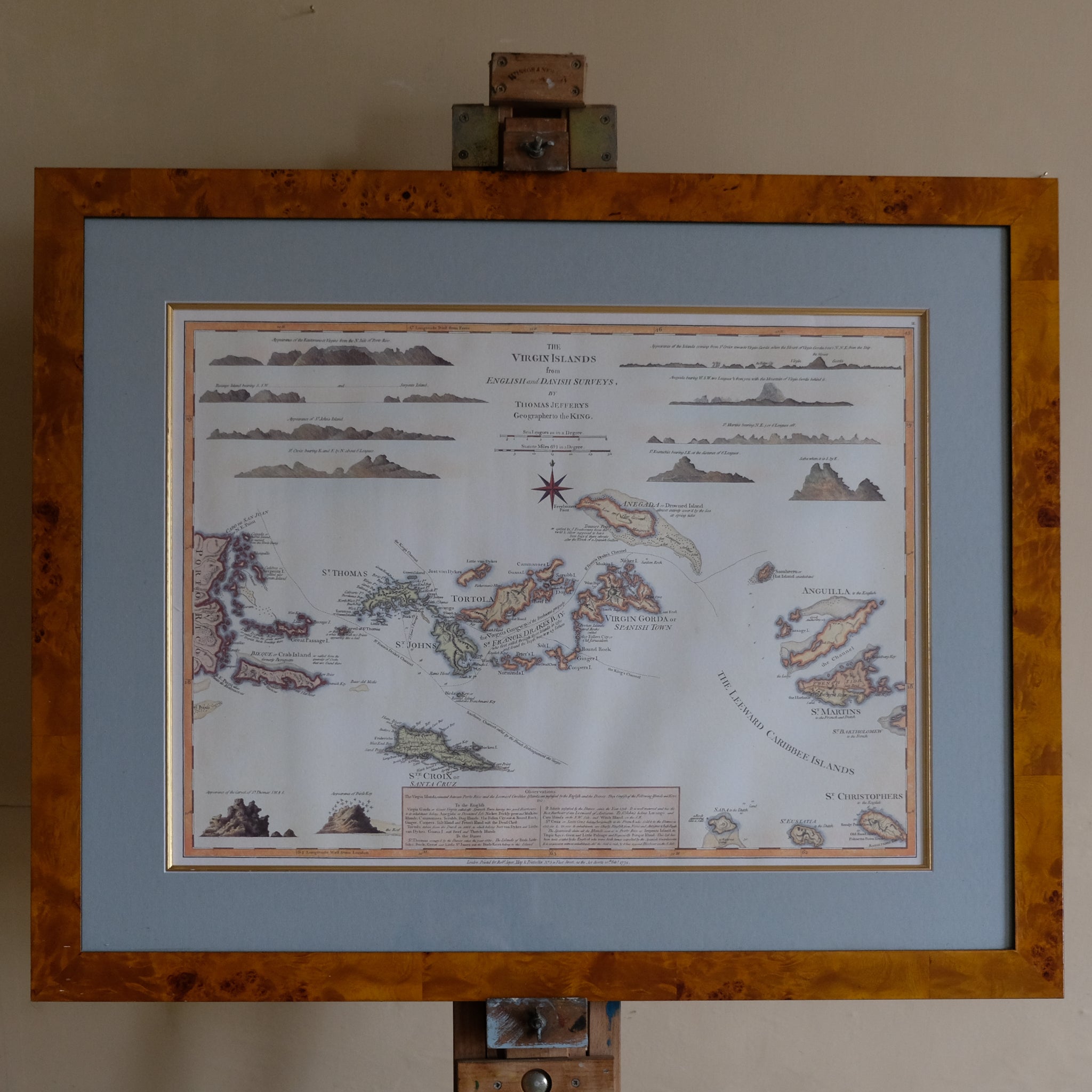
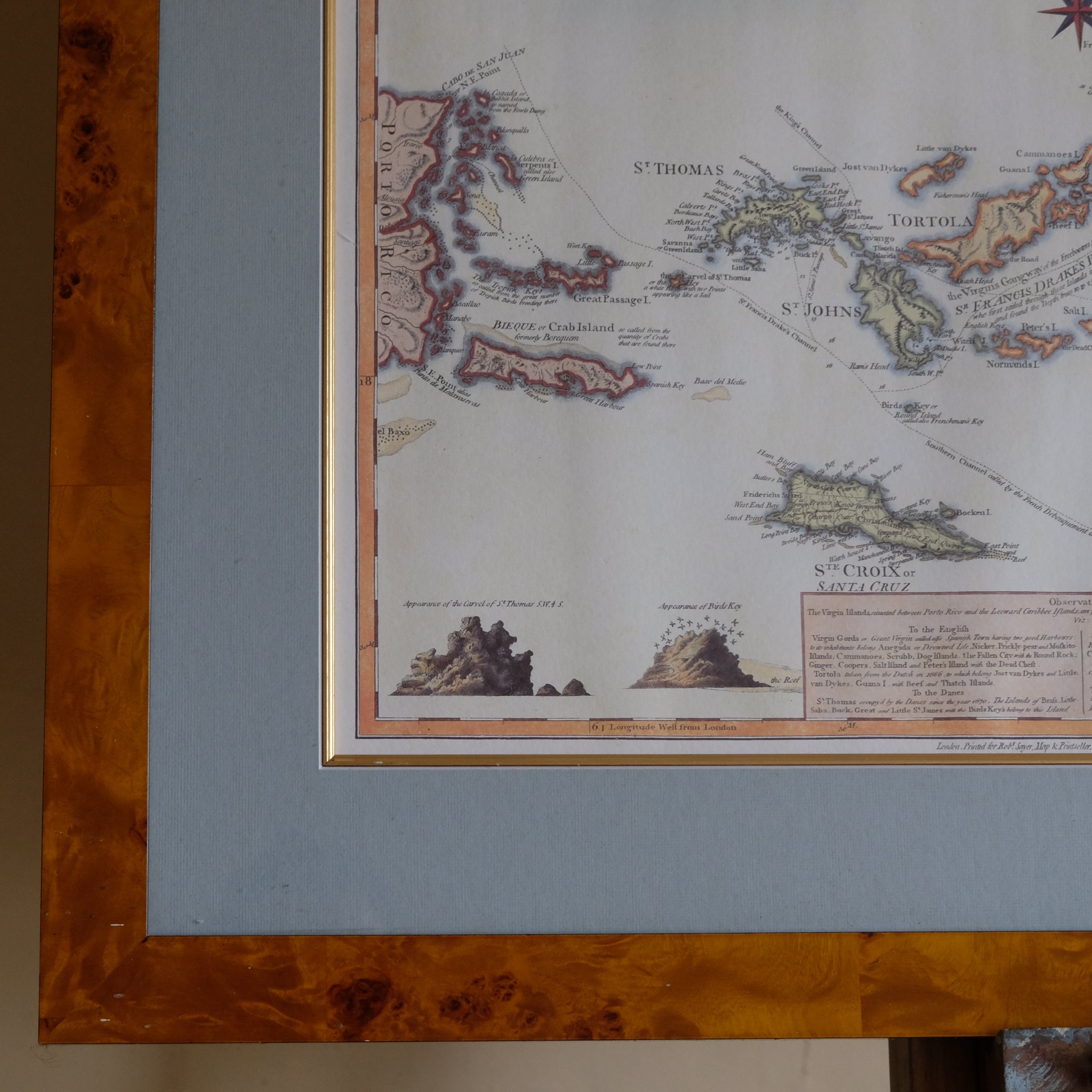
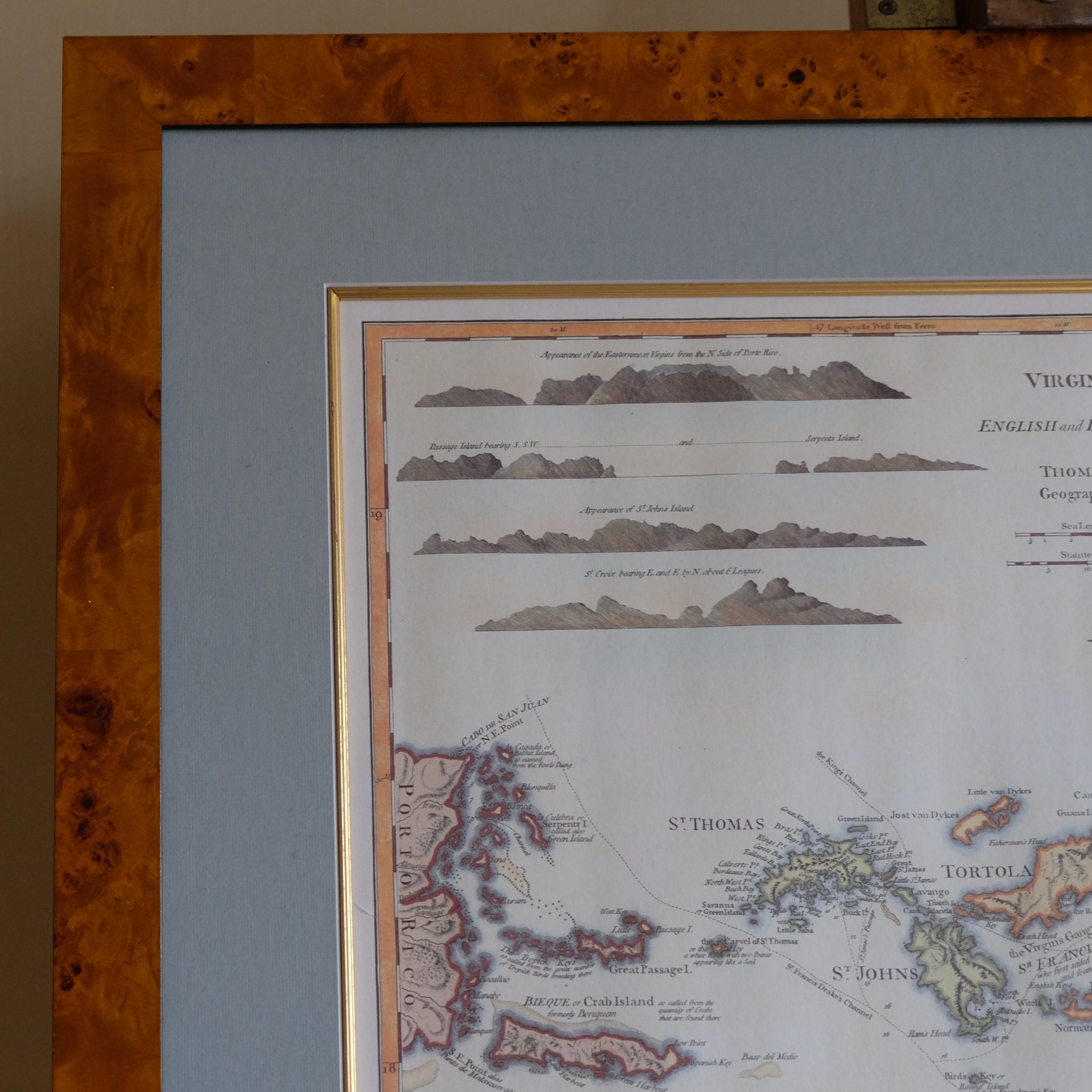
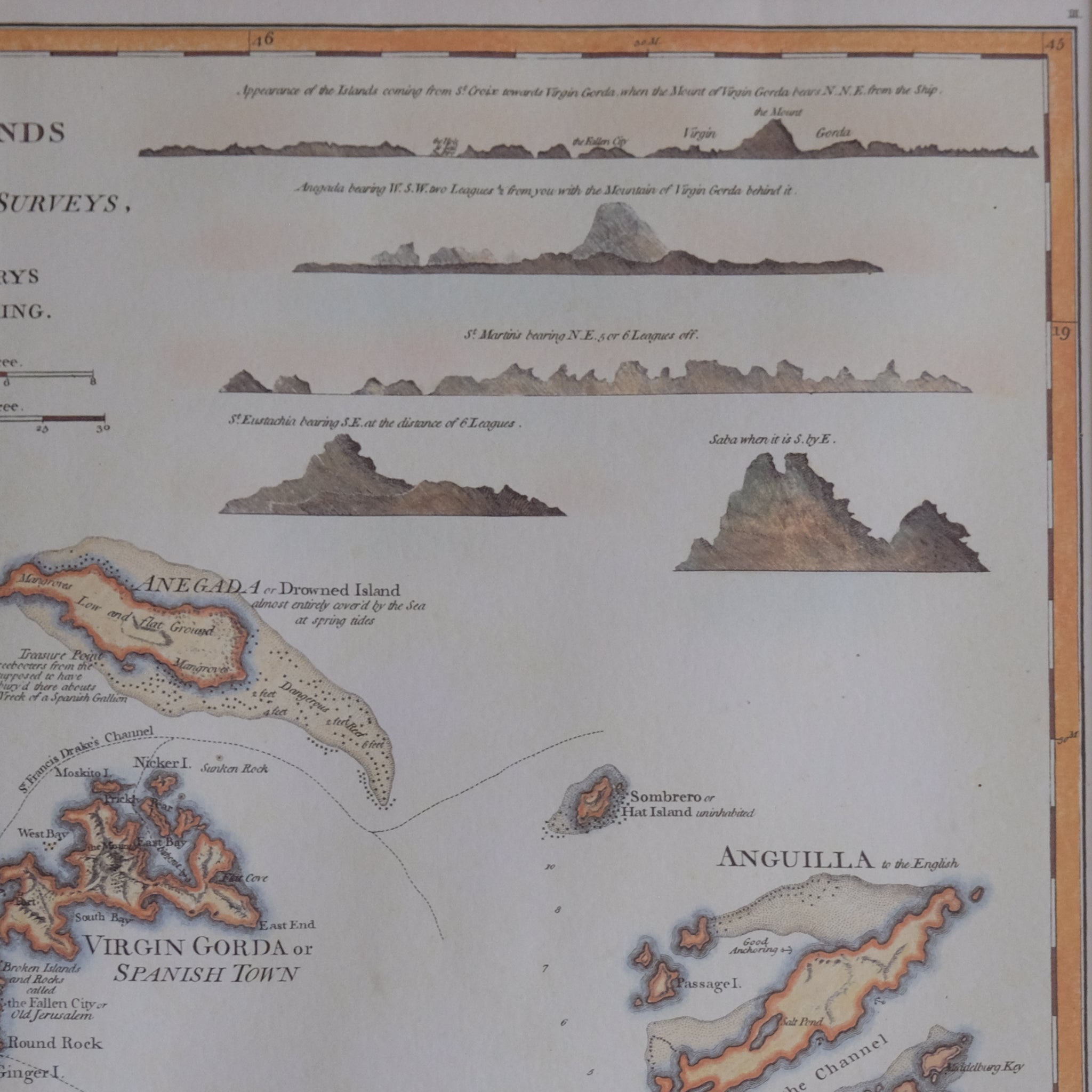
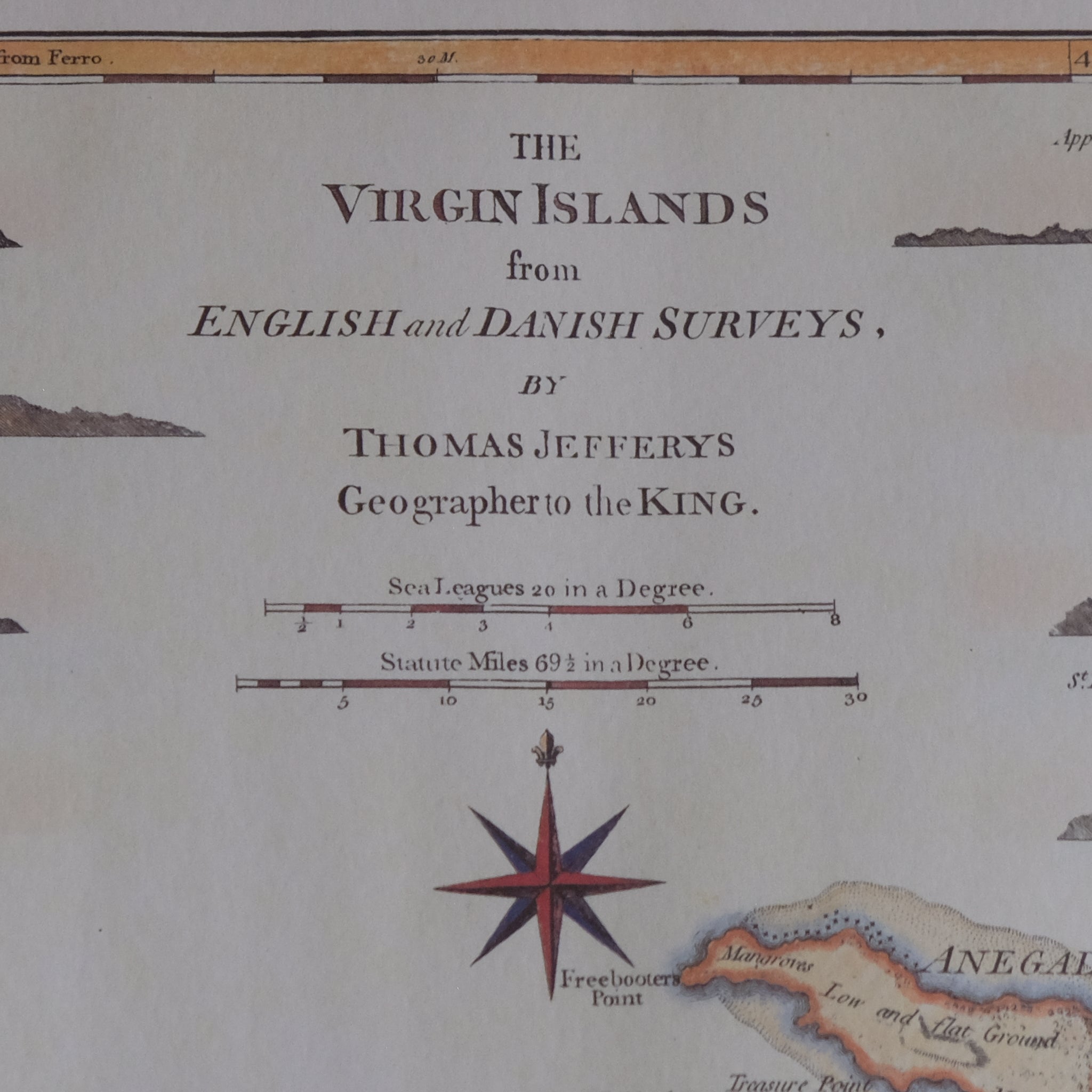
THE VIRGIN ISLANDS FROM ENGLISH AND DANISH SURVEYS
International delivery available — please contact us for a quote.
Characteristics
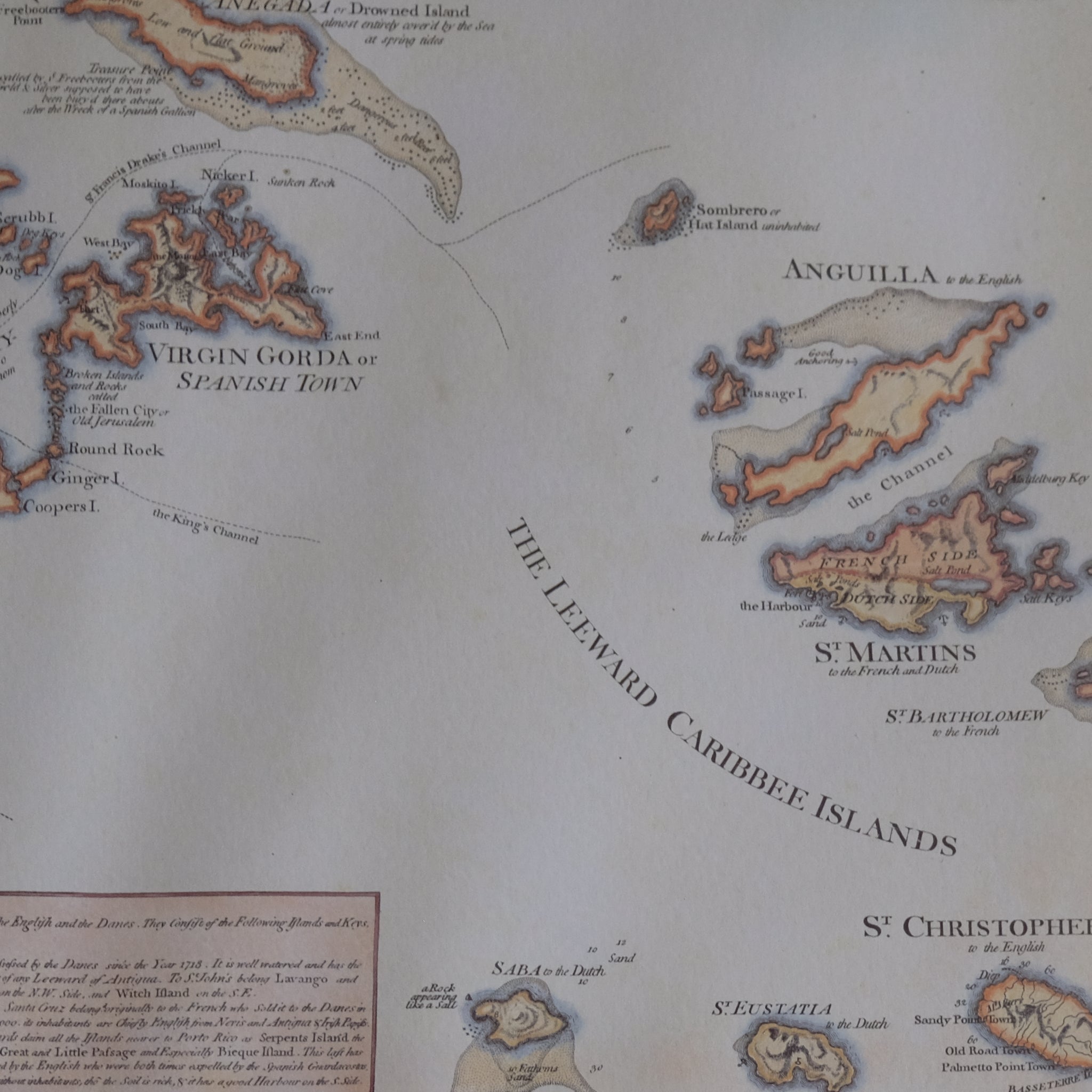
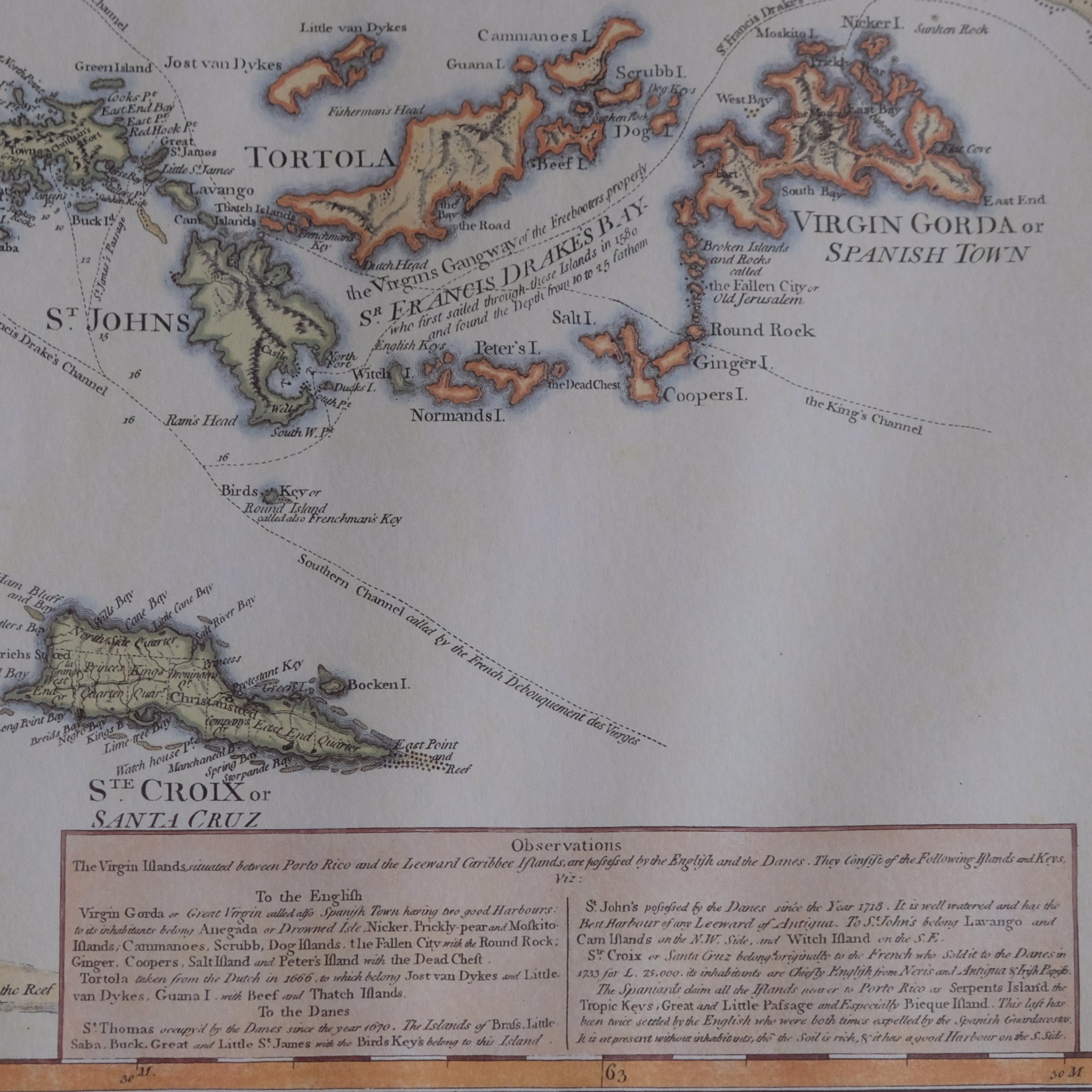
The Virgin Islands from English and Danish Surveys
By Thomas Jefferys, 1775
A highly decorative and historically important 18th-century engraved map of the Virgin Islands and surrounding Caribbean territories by the renowned British cartographer Thomas Jefferys, published in 1775 and beautifully enhanced with contemporary hand colouring.
Drawn from English and Danish surveys, this detailed map encompasses the Virgin Islands archipelago, including St Thomas, St John, Tortola, Virgin Gorda and neighbouring islands, extending westwards towards the eastern coast of Puerto Rico and eastwards to Anguilla, St Martin and St Christopher (St Kitts). The chart is enriched with coastal profiles, navigational observations, anchorages and maritime information of considerable importance to 18th-century seafarers and merchants operating in the Caribbean.
Jefferys was one of the foremost cartographers of the Georgian period, serving as Geographer to King George III and producing some of the most influential maps of the British colonies and overseas territories. His work remains highly sought after for its combination of geographical accuracy, historical significance and visual appeal.
The map is attractively presented in a handsome burr wood frame with a complementary mount, creating an elegant display piece suitable for both traditional and contemporary interiors.
Technical Information
Date: 1775
Framed: 67.5 x 82.5 x 2 cm.
Choose options